To backpack down into the Grand Canyon (i.e., to hike down, camp there, then hike out) you have two options:
1) Submit a FAXED permit request over a month in advance, then wait three weeks for the MAILED response. Or, 2) Show up at 7 a.m. and hope they have a last-minute permit left.
In keeping with our "screw it, let's just wing it" strategy for the past three months, we'll go with door number 2.
Just in case it works out, we OBVIOUSLY have to stock up on beans. Lots of beans.
Let the fart jokes commence...
So we show up a little late... like after 8 a.m. We don't have any pictures, but the sunrise drive from Flagstaff was pretty surreal -- up into the mountains, then across a fog-draped Kaibab Plateau at 7,000 feet, through the remnants of a forest fire still there from the last time I was here four years ago, and finally out of the trees just as you hit the canyon. While we wait in line, here's our (intended) 7-mile route down...
...and our 12-mile route back up. Oh, what's that you say? It's only 9 miles up? Well, we're not going to notice that until tomorrow on our way up, thanks.
WE GOT A PERMIT! Apparently only a few people are dumb enough to do this in the depths of winter. Fortunately, the temperature difference between the rim and the bottom of the canyon is 30+ degrees, so it will only hit 30 degrees overnight, not 11.
This shot is NOT fake. They did NOT pose for it. It is 100% candid. I am NOT lying. I'm NOT. REALLY.
So, here's the thing. We weren't really prepared AT ALL for this trip -- at least, in the sense that we basically had enough space for 75% of our stuff. Note the pot tied to the outside of the green bag above -- 1840s prospector-style.
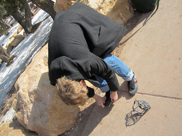
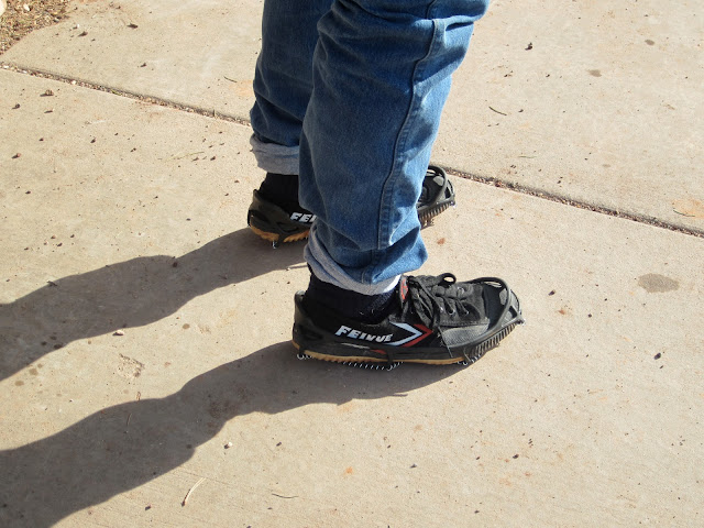
Oh, and the first two (and, therefore, the last two) miles of the round trip are all ice and packed snow. Good thing two of us got mini-crampons for that stretch. Key word: two.
They look flimsy, but they're actually awesome and totally work. Twenty bucks. Who knew? They're even good for walking to work in the snow and stuff like that.
Almost ready to go...
So optimistic. So ready for what's ahead. Or so we thought.
Boom.
At this point, it becomes very clear that Laura's brand new boots are not in any way capable of helping with the ice and packed snow. And she's not one of the two who got shoe traction things...
...and it's a long way down if you fall.
I think at this point Pete gives Laura his spikes and reverts to his ninja shoes. Somehow his tiny shoes worked even better than our boots with spikes, which were working pretty well themselves.
Here's the much-too-long video that drained the camera's battery to five percent only 20 minutes into the hike. "Did I remember to bring the extra camera battery that I bought specifically for this type of situation?" Take a guess...
Taking pictures while we still can...
A little over an hour in. Finally. Dry land. Right...?
From the south rim of the Grand Canyon down to the Colorado River is just short of a mile vertical. Every time you look down and think "I almost see the bottom" you're wrong. You don't see the bottom. It's nowhere near where you think it is. But here's the thing -- on the way back up, when you look up and think you see the top, you're probably right: it's all the way the hell up there... and it doesn't seem to be getting any closer.
Almost out of the shadows...this means no more snow, right?
Two hours in, with the Tonto Platform (that green-ish flat part) still well below us.
Nope, still plenty of snow.
Made it to the rest house. Ok now the snow is FINALLY over. Now it's just four-inch-thick mud...
...and this guy. An ominous warning, perhaps. But, as a Baltimorean, I have to interpret a raven sighting as a good sign...right?
Mules carry supplies up and down the canyon every day. Oh, and to answer the question that some of you may be asking: no, we didn't stay at Phantom Ranch in one of the cabins. We slept in a tent. OBVIOUSLY.
"Wow this is cool. How do we give it some sense of perspective in the picture?"
Really guys? THAT'S what you thought of? Chalk this one up to fatigue...
Heading into the redwall limestone
Resting, to prep for...
...this.
"Don't pose, just act naturally."
Heavy sigh...
Ok I lied, there's the bottom. But it's still at least two hours away.
In none of these pictures do we look any closer to the bottom...
Forgot to mention that the weather was pretty crappy the past several days, but then it totally cleared up for us today.
Fiiiiiinally made it to the Tonto Platform
Lunch time at Tip Off rest house (I think)
"Look how close we are!" Not close. We were not close.
30 minutes later. "Wait. We don't look any closer...???"
Triple portrait
Ok NOW we're getting closer. For real. About an hour left. See those yellow Cottonwoods down there? That's our campground. At 6 am the next morning we'd be walking across that bridge to the left in the dark.
Gorilla Abe Lincoln?
Mustering a smile (actually, Pete was fine, we were the achy ones)
MADE IT! Welcome to the totally murky Colorado River and Bright Angel Campground
Wait for it...
Waiiiiit for it...
Annnnd the camera battery died. Switching to phones.
"Let's take a picture where we look tired, like we just carried forty pounds down to the bottom of the Grand Canyon"
"No, look TIRED"
"Good enough."
Yes, technically there are bathrooms down there. Sort of.
WAKE UP! 5 am wake-up call. By 6:15 we were packed up and back on the trail.
The plan was to get back up to the rim before 4 pm so that we could get Winter from the kennel without having to pay for an extra day. 12-mile hike, going about 1.5 miles per hour-- that's about 2 pm, plus breaks. Cutting it close...
After about an hour in the dark, the sun starts to come up, and we're a little over a mile in
Going down was...
...much easier. See the two tiny people down there? THEY CAUGHT UP TO US.
Three miles in
4.5 miles and three hours in. Finally a real pack-free rest. At this point we realize that the trip up is NINE miles, not TWELVE. Just saved three miles... not sure if we would've made it to twelve. At least we'll easily get to the kennel to pick Winter up before 4...right...?
After a quick totally-freezing-because-our-packs-are-making-us-sweat-and-the-sky-is-overcast lunch, we set out for the final 4.5-mile stretch.
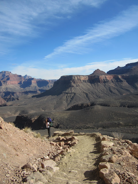
That's the top way up there. May not look like much, but it was twice as steep as the rest of the hike up, and mostly covered in snow.
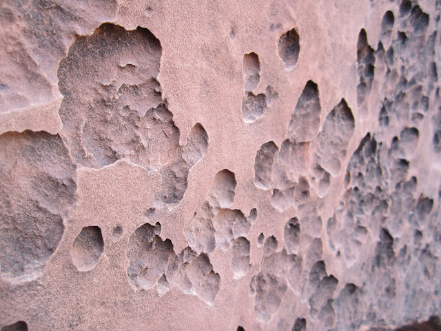
An hour or two later, I noticed this in the rock and remembered that the elevation at the rim is over 7,000 feet. That means we have to climb about a vertical half mile in three miles of hiking...
I mean, it SEEMS close to the top, right?
But it's just kind of...not.
1.5 miles left... Now we're down to 1 mph at best. The poutine in Montreal, the Italian beef in Moline, the fish tacos all over California -- regretting them all right about now.
The sun never really came out, except for one tiny point where that switchback... switches...back? We suddenly hear this boisterous guffaw. "Is that Pete way up there?"
Yes indeed. Pete hiked MUCH faster than we did. Yoga does a body good.
We found him with the two guys who passed us on the way up (the two tiny dots from allll the way down below, about 20 pictures ago. Turns out this guy is a spinning instructor for the Marines. Ok I feel a LITTLE better about myself now.
It looks SO CLOSE! Just a quarter mile left... we can make it.
DONE. We survived. Start clapping. CLAP DAMMIT
Pete took all the group pictures, so I'll have to add those later, but hopefully this is testament enough.
Next time, the craziness begins: a cautionary tale of what happens when you try to see the southwest in 48 hours during a snowstorm.


No comments:
Post a Comment